
Add real estate maps, points of interest and neighbourhood data to Python applications.
yatmo is the official Python client for the Yatmo API: the written neighbourhood text of
a property (rendered as HTML on the server, so search engines index it), the nearest schools, nurseries,
supermarkets and public transport with real travel times, scores, listing enrichment, isochrones, routes,
geocoding and static map images, in 25 countries and 23 languages. Works with Django, Flask, FastAPI, notebooks
and scripts, Python 3.9 and later, no dependency.
pip install yatmofrom yatmo import Client, TravelMode, render_html
yatmo = Client(key="your_backend_key", country="BE", language="FR")
# The neighbourhood text as HTML, to write into the property page.
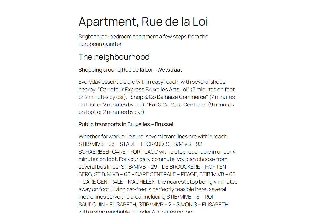
text = yatmo.summary_text(50.8461, 4.3664)
print(render_html(text))
# <div class="yatmo-text"><h3>Commerces près de la Rue de la Loi</h3><p>Un <strong>Carrefour</strong> à 3 minutes...
# The nearest places by category with walking times.
summary = yatmo.summary(50.8461, 4.3664)
for sub in summary.sub_categories():
place = sub.places[0] if sub.places else None
walk = place.travel(TravelMode.WALKING) if place else None
print(sub.label, ":", place.name if place else "-", walk.travel_time_short_label if walk else "")
- Get a Yatmo licence key at yatmo.com and use the backend key on the server (keys explained).
pip install yatmo.- Create one
Clientper country, callsummary_text()andsummary()for each property, cache the answers (a neighbourhood rarely changes;summary_text_raw()andsummary_raw()return plain dicts for that) and write the HTML into the page.
Runnable example: examples/property_page.py. The interactive map itself is an iframe with your frontend key, no Python needed: iframe plugin.
yatmo = Client(
    key="your_backend_key",
    country="BE",                 # the API host is https://be.yatmo.com/
    language="FR",                # labels and texts, default EN
    transport=None,               # optional: any object with get(url, headers, timeout_seconds) -> (status, body)
    timeout_seconds=15,
)| Method | Endpoint | Returns |
|---|---|---|
summary(lat, lng) |
/summary |
Summary: places by category with distances and travel times (walking, bicycling, driving, transit), closest cities, reverse-geocoded place |
summary_text(lat, lng, language=None) |
/Summary/text |
SummaryText in one language, paragraphs with [STRONG] markers; see the renderers |
summary_text_raw(lat, lng), summary_raw(lat, lng), scores_raw(lat, lng) |
The API answers as plain dicts, to cache; rebuild with SummaryText.from_wire(raw, language), Summary.from_wire(raw), Scores.from_wire(raw) |
|
scores(lat, lng) |
/scores |
Scores: one 0 to 10 score per category |
enrichment(lat, lng) |
/enrichment |
Ready-made listing attributes (nearest place per category, four travel modes), as a dict |
points(south, west, north, east, poi_type_ids=()) |
/points |
Poi list inside a bounding box |
simplified_categories() |
/SimplifiedCategories |
CategoryGroup list (name, POI type ids) |
isochrones(lat, lng, mode) |
/Isochrone/GetMultipleTimes |
5, 10 and 20 minute areas, GeoJSON geometries |
isochrone(lat, lng, mode, seconds) |
/isochrone |
One area, GeoJSON geometry |
route(from_lat, from_lng, to_lat, to_lng, mode) |
/route |
Route with paths (distance, duration, LineString) |
geocode(address) |
/geolocation |
Place list, best match first |
geocode_near(lat, lng, query) |
/Geolocation/GetClose |
Address autocomplete around a point |
static_map(lat, lng, **options) |
/image |
JPEG bytes; static_map_url() gives the URL (color, width, height, map_style, three_d, big_icons, multi_borders, custom_marker) |
Errors are typed: BadRequestError (400, position outside the country), AuthenticationError (401),
ForbiddenError (403, country or endpoint not in the licence), QuotaError (429), TransportError
(unreachable), all subclasses of YatmoError with a status.
render_html(text, heading="h3", titles="street-city", paragraphs=None, strong=True, css_class="")
render_markdown(text, titles="street-city", paragraphs=None, strong=True)
render_plain(text, titles="street-city", paragraphs=None)titles: the first heading names the street and the second the city ("street-city"), the city only
("city", for discreet listings) or neither ("generic"). paragraphs keeps some icon ids only among
education, shopping, publictransports, transports, tourism, cities.
# Django view
from django.core.cache import cache

def listing(request, pk):
    listing = Listing.objects.get(pk=pk)
    key = f"yatmo-text-{listing.latitude:.6f}-{listing.longitude:.6f}"
    raw = cache.get(key)
    if raw is None:
        raw = yatmo.summary_text_raw(listing.latitude, listing.longitude)
        cache.set(key, raw, 30 * 86400)
    neighbourhood = render_html(SummaryText.from_wire(raw, request.LANGUAGE_CODE))
    return render(request, "listing.html", {"listing": listing, "neighbourhood": neighbourhood})
In the template: {{ neighbourhood|safe }} below the map iframe.
python -m unittest discover tests                       # hermetic, the API is faked
YATMO_LIVE_KEY=your_backend_key python -m unittest tests.test_live # one real call per endpoint- Yatmo and its documentation
- Same client for other stacks: JavaScript, PHP, .NET
- WordPress plugin, Odoo module, Drupal module, MCP server for AI assistants
- More examples
MIT licence. Yatmo is a paid service for real estate portals, agency networks and developers; a licence key is required.